
Stage 02
Eshott Airfield (EGFL) to Charterhall Airfield (EGFQ)
Northumberland Coast to the Scottish Borders
Distance
47.7 NM
47.7 NM
Est. Time (ETE)
00h 35m
00h 35m
Target Alt
1,500–2,000 ft
1,500–2,000 ft
Touch & Gos
1 Airfield
1 Airfield
This scenic VFR leg tracks north along the dramatic Northumberland coastline before swinging inland along the Anglo-Scottish border.
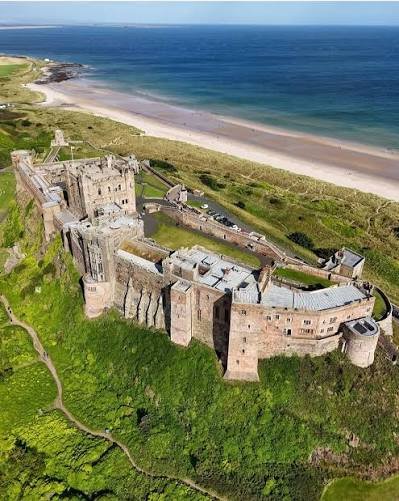
Enjoy striking coastal views over iconic landmarks like Lindisfarne (fog on the tyne?) and Bamburgh Castle – once the ancient capital of the Kingdom of Northumbria – it’s also famous as the real-life Bebbanburg from The Last Kingdom series.
Route past the Cheviot Hills towards the final point in the route, a former WWII RAF station notorious among wartime trainees for its hazardous, misty weather. It earned the grim nickname “Slaughterhall” and is where The Last Enemy author and Spitfire ace Richard Hillary tragically lost his life during a night-training flight in 1943.
Route Map & Radio Navaids Visual
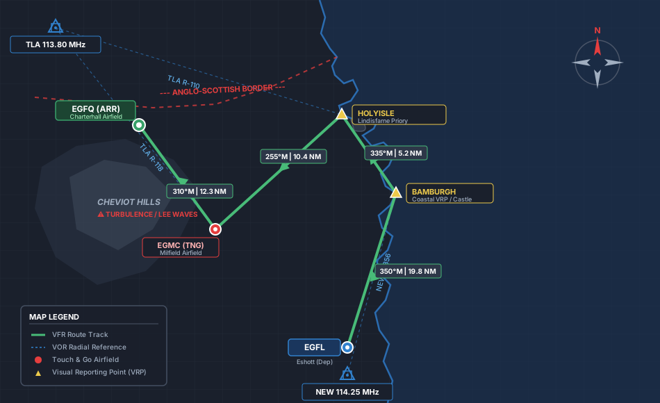
NEW VOR/DME (114.25): Outbound reference along Northumberland coastline (R-356)
TLA VOR/DME (113.80): Cross-border tracking to Milfield & Charterhall (R-110)
ESHOTT SAFETYCOM (122.855): Local CTA departure & airfield traffic coordination
Navigation & Waypoint Breakdown
| Ident | Type | Track (°M) | Nav Aid / Radial | Alt | Leg | Total | ETE | Landmarks & Notes |
|---|---|---|---|---|---|---|---|---|
| EGFL | Departure | — | NEW 114.25 R-360 | 197 ft | 0.0 NM | 0.0 NM | 00:00 | Takeoff Eshott; track north towards the coastline. |
| BAMBURGH | Coastal VRP | 350° | NEW 114.25 R-356 | 2,000 ft | 19.8 NM | 19.8 NM | 00:10 | Pass directly over iconic Bamburgh Castle on the basalt crags. |
| HOLYISLE | Scenic VRP | 335° | TLA 113.80 R-110 | 2,000 ft | 5.2 NM | 25.0 NM | 00:13 | Circle Holy Island / Lindisfarne Castle; track southwest inland. |
| EGMC | Touch & Go | 255° | TLA 113.80 R-118 | Circuit | 10.4 NM | 35.4 NM | 00:22 | Milfield Airfield (Grass); touch & go near the Cheviot foothills. |
| EGFQ | Arrival | 310° | TLA 113.80 R-105 | 380 ft | 12.3 NM | 47.7 NM | 00:35 | Cross Anglo-Scottish border into Berwickshire for full stop. |
Stage Highlights & Scenic Landmarks

Radio Navigation Frequencies
- Talla VOR/DME (TLA): 113.80 MHz
- Newcastle VOR/DME (NEW): 114.25 MHz
- Eshott SafetyCom: 122.855 MHz
- Scottish Information: 119.875 MHz
Local Cautions & Procedures
- High Ground & Turbulence: Watch for lee waves and severe downdrafts when flying near the Cheviot Hills west of Milfield.
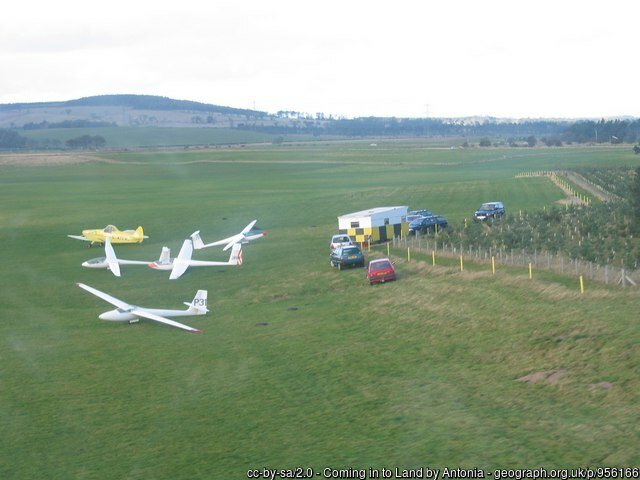
- Glider Activity: Milfield (EGMC) is a busy winch-launching glider center. Keep sharp lookout and maintain radio contact.
- Charterhall Join: Uncontrolled airfield; give way to active circuit traffic and announce intentions on SafetyCom.
Download MSFS Flight Plan (.PLN)
Copy the XML snippet below and save it as UK_Coastal_Stage_02.pln to load directly into Microsoft Flight Simulator:
<?xml version="1.0" encoding="UTF-8"?>
<SimBase.Document>
    <FlightPlan.FlightPlan>
        <Title>EGFL to EGFQ Stage 2 UK Coastal Circumnavigation</Title>
        <FPType>VFR</FPType>
        <RouteType>Direct</RouteType>
        <CruisingAlt>2000</CruisingAlt>
        <DepartureID>EGFL</DepartureID>
        <DepartureLLA>N55° 16' 42.06",W1° 43' 13.76",+000196.50</DepartureLLA>
        <DestinationID>EGFQ</DestinationID>
        <DestinationLLA>N55° 42' 18.00",W2° 21' 40.00",+000380.00</DestinationLLA>
        <ATCWaypoint id="EGFL">
            <ATCWaypointType>Airport</ATCWaypointType>
            <WorldPosition>N55° 16' 42.06",W1° 43' 13.76",+000196.50</WorldPosition>
            <ICAO><ICAORegion>EG</ICAORegion><ICAOIdent>EGFL</ICAOIdent></ICAO>
        </ATCWaypoint>
        <ATCWaypoint id="BAMBURGH">
            <ATCWaypointType>User</ATCWaypointType>
            <WorldPosition>N55° 36' 32.00",W1° 42' 35.00",+002000.00</WorldPosition>
        </ATCWaypoint>
        <ATCWaypoint id="HOLYISLE">
            <ATCWaypointType>User</ATCWaypointType>
            <WorldPosition>N55° 40' 44.00",W1° 48' 00.00",+002000.00</WorldPosition>
        </ATCWaypoint>
        <ATCWaypoint id="EGMC">
            <ATCWaypointType>Airport</ATCWaypointType>
            <WorldPosition>N55° 35' 22.00",W2° 3' 40.00",+000266.00</WorldPosition>
            <ICAO><ICAORegion>EG</ICAORegion><ICAOIdent>EGMC</ICAOIdent></ICAO>
        </ATCWaypoint>
        <ATCWaypoint id="EGFQ">
            <ATCWaypointType>Airport</ATCWaypointType>
            <WorldPosition>N55° 42' 18.00",W2° 21' 40.00",+000380.00</WorldPosition>
            <ICAO><ICAORegion>EG</ICAORegion><ICAOIdent>EGFQ</ICAOIdent></ICAO>
        </ATCWaypoint>
    </FlightPlan.FlightPlan>
</SimBase.Document>