
Tay Estuary, Angus & Grampian Coast
Fife (EGPJ) → Kingsmuir (EGQD) → Montrose → Stonehaven → Longside (EG29)
~82 NM
2,000 ft – 2,500 ft
Aberdeen CTA / Class D
48 mins
Flight Briefing & Route Description
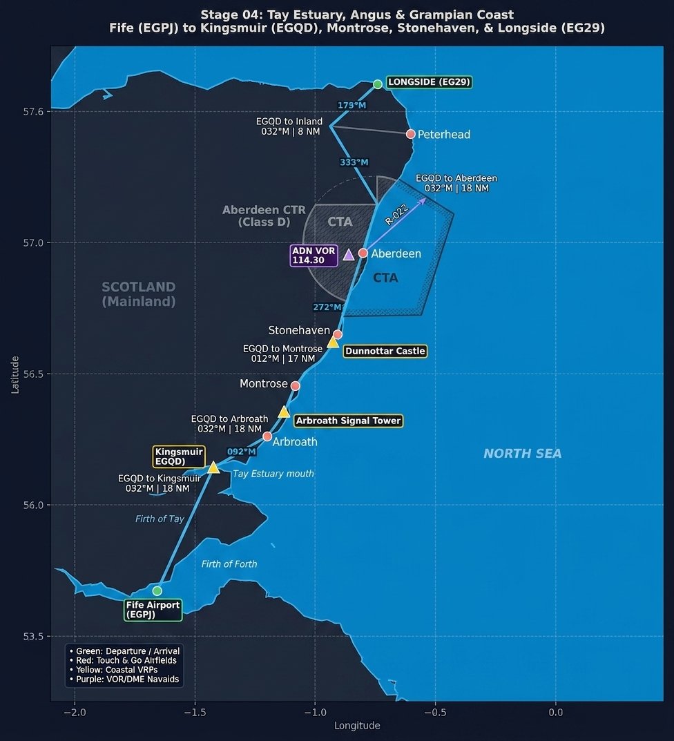
Stage 4 takes you north out of Fife across the Firth of Tay and tracks along the dramatic Angus and Grampian coastlines into Aberdeenshire. Departing Fife (EGPJ), you’ll make a short hop eastbound to Kingsmuir (EGQD) for an optional grass-strip touch-and-go before setting a course over St Andrews and across the Tay Estuary.
Following the coast past Arbroath and Montrose, you’ll thread past the clifftop fortress of Dunnottar Castle near Stonehaven. As you push further north, careful navigation is required beneath the Aberdeen Control Area (CTA) before turning inland past Peterhead to terminate at Longside (EG29), the former RAF airfield serving as your northeastern turnaround point.
Navigation Aids & Radio Frequencies
Leg-by-Leg Navigation Log
Leg 1: Fife (EGPJ) → Kingsmuir (EGQD)
092°M | 8.5 NM | ~5 mins
- Departure: Depart Fife Runway 24/06 and make an eastbound turn toward the East Neuk of Fife, climbing to 1,500 ft AGL.
- Routing: Track east past St Andrews Bay. Kingsmuir airfield is an unpaved grass strip nestled inland south of St Andrews.
- Touch-and-Go: Join the circuit for Kingsmuir (EGQD) for a quick grass-strip touch-and-go before re-climbing to 2,000 ft.
Leg 2: Kingsmuir (EGQD) → Arbroath / Montrose
032°M | 18.0 NM | ~11 mins
- Routing: Cross the Firth of Tay staying clear of RAF Leuchars MATZ / Danger Areas if active. Look for the Tay Road Bridge to the west.
- Landmarks: Track over Arbroath to spot the historic Arbroath Signal Tower at the harbor, continuing past the tidal basin of Montrose Basin.
- Airspace Note: Monitor Leuchars Approach (126.500 MHz) for traffic information while crossing the Tay estuary.
Leg 3: Montrose → Stonehaven (Dunnottar Castle)
022°M | 19.5 NM | ~12 mins
- Coastal Track: Follow the coastal cliffs north towards Stonehaven, maintaining 2,000 ft.
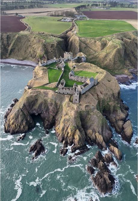
- Highlight: Fly past Dunnottar Castle, perched dramatically on a rocky headland just south of Stonehaven harbor.
- Pre-CTA Check: Contact Aberdeen Radar (119.050 MHz) before proceeding past Stonehaven as you approach the Aberdeen CTA base.
Leg 4: Stonehaven → Longside (EG29)
028°M | 36.0 NM | ~22 mins
- Routing: Route offshore or strictly beneath the Aberdeen Controlled Airspace, passing east of Aberdeen city and the Buchan coast.
- Landmarks: Track towards the prominent Peterhead coastline and turn inland north of Boddam.
- Arrival: Join the circuit for Longside (EG29) for your full-stop landing on the hard runway, completing the northeastern leg of the tour.
Stage Highlights
Tay Road Bridge & Estuary
Sweeping twin bridges spanning the Firth of Tay connecting Fife to Dundee.

Dunnottar Castle
A striking medieval fortress ruin situated on an isolated cliff jutting into the North Sea.
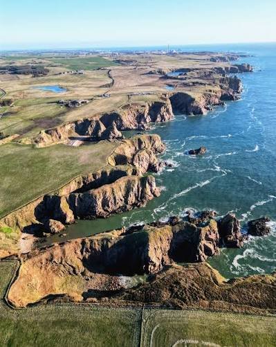
Peterhead & Buchan Coast
Rugged Aberdeenshire coastline leading inland towards the historic ex-RAF Longside strip.
“`