
Stage 05
Longside Airfield (EG29) to Inverness Airport (EGPE)
Moray Firth Coastline & Highland Gateway
Distance
78.5 NM
78.5 NM
Est. Time (ETE)
00h 47m
00h 47m
Target Alt
2,500–3,500 ft
2,500–3,500 ft
Touch & Gos
0 (Full Stop)
0 (Full Stop)
Route Map & Radio Navaids Visual
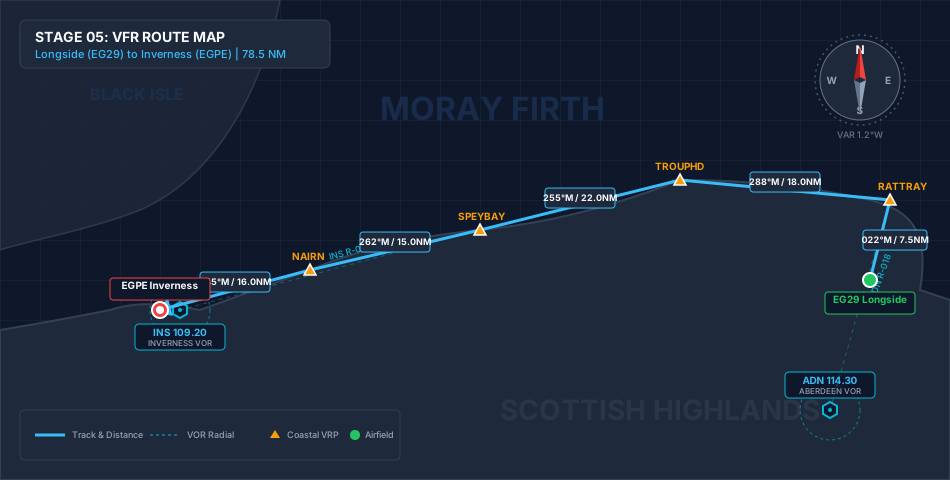
ADN VOR/DME (114.30): Outbound radial reference along Aberdeenshire coast
INS VOR/DME (109.20): Inbound tracking reference direct to Inverness
LOSSIEMOUTH RADAR (119.350): MATZ & ATZ transit coordination
Navigation & Waypoint Breakdown
| Ident | Type | Track (°M) | Nav Aid / Radial | Alt | Leg | Total | ETE | Landmarks & Notes |
|---|---|---|---|---|---|---|---|---|
| EG29 | Departure | — | ADN 114.30 R-020 | 180 ft | 0.0 NM | 0.0 NM | 00:00 | Depart Longside; climb north towards coastal turning point. |
| RATTRAY | Coastal VRP | 022° | ADN 114.30 R-018 | 2,500 ft | 7.5 NM | 7.5 NM | 00:04 | Rattray Head Lighthouse; turn west into the Moray Firth. |
| TROUPHD | Coastal VRP | 288° | ADN 114.30 R-338 | 3,000 ft | 18.0 NM | 25.5 NM | 00:15 | Track past Fraserburgh to Troup Head; scenic sea cliffs. |
| SPEYBAY | Reporting Pt | 255° | INS 109.20 R-072 | 2,500 ft | 22.0 NM | 47.5 NM | 00:28 | Banff Bay & Cullen; contact Lossiemouth Zone for MATZ transit. |
| NAIRN | Inbound VRP | 262° | INS 109.20 R-065 | 2,000 ft | 15.0 NM | 62.5 NM | 00:37 | Coast-track past Burghead; set up for Inverness CTR entry. |
| EGPE | Arrival | 245° | INS 109.20 R-055 | 31 ft | 16.0 NM | 78.5 NM | 00:47 | Cross Culbin Sands; join Inverness circuit for full-stop landing. |
Stage Highlights & Scenic Landmarks

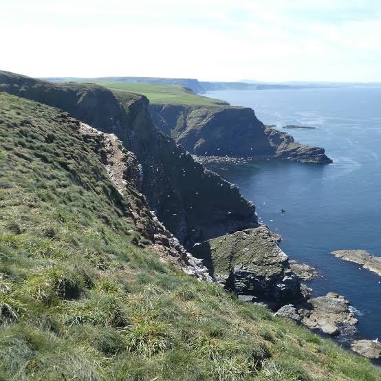
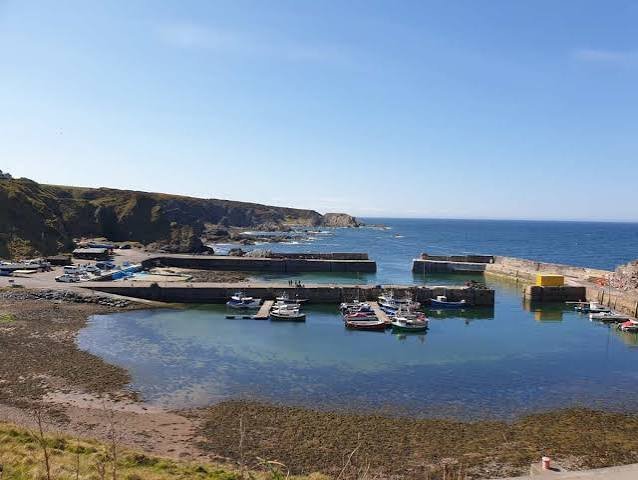
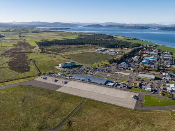
Radio Navigation & ATC Frequencies
- Aberdeen VOR/DME (ADN): 114.30 MHz
- Inverness VOR/DME (INS): 109.20 MHz
- Lossiemouth Zone/Radar: 119.350 MHz
- Inverness Approach/Radar: 122.605 MHz
- Inverness Tower: 118.405 MHz
Local Cautions & Airspace Procedures
- Military Fast Jets: High-speed RAF Typhoon traffic active around Lossiemouth MATZ. Maintain sharp visual lookout and radio contact.
- Class D CTR Inbound: Two-way radio clearance required prior to entering Inverness CTR. Nairn is a key visual inbound join point.
- Coastal Weather & Sea Fog: Moray Firth coastline is susceptible to sudden sea fog (haar) rolling inland off the North Sea.
Download MSFS Flight Plan (.PLN)
Copy the XML snippet below and save it as UK_Coastal_Stage_05.pln to load directly into Microsoft Flight Simulator:
<?xml version="1.0" encoding="UTF-8"?>
<SimBase.Document>
    <FlightPlan.FlightPlan>
        <Title>EG29 to EGPE Stage 5 UK Coastal Circumnavigation</Title>
        <FPType>VFR</FPType>
        <RouteType>Direct</RouteType>
        <CruisingAlt>3000</CruisingAlt>
        <DepartureID>EG29</DepartureID>
        <DepartureLLA>N57° 30' 15.00",W1° 53' 05.00",+000180.00</DepartureLLA>
        <DestinationID>EGPE</DestinationID>
        <DestinationLLA>N57° 32' 24.00",W4° 03' 00.00",+000031.00</DestinationLLA>
        <ATCWaypoint id="EG29">
            <ATCWaypointType>Airport</ATCWaypointType>
            <WorldPosition>N57° 30' 15.00",W1° 53' 05.00",+000180.00</WorldPosition>
            <ICAO><ICAORegion>EG</ICAORegion><ICAOIdent>EG29</ICAOIdent></ICAO>
        </ATCWaypoint>
        <ATCWaypoint id="RATTRAY">
            <ATCWaypointType>User</ATCWaypointType>
            <WorldPosition>N57° 36' 36.00",W1° 49' 00.00",+002500.00</WorldPosition>
        </ATCWaypoint>
        <ATCWaypoint id="TROUPHD">
            <ATCWaypointType>User</ATCWaypointType>
            <WorldPosition>N57° 41' 30.00",W2° 19' 30.00",+003000.00</WorldPosition>
        </ATCWaypoint>
        <ATCWaypoint id="SPEYBAY">
            <ATCWaypointType>User</ATCWaypointType>
            <WorldPosition>N57° 40' 20.00",W3° 05' 10.00",+002500.00</WorldPosition>
        </ATCWaypoint>
        <ATCWaypoint id="NAIRN">
            <ATCWaypointType>User</ATCWaypointType>
            <WorldPosition>N57° 35' 00.00",W3° 52' 00.00",+002000.00</WorldPosition>
        </ATCWaypoint>
        <ATCWaypoint id="EGPE">
            <ATCWaypointType>Airport</ATCWaypointType>
            <WorldPosition>N57° 32' 24.00",W4° 03' 00.00",+000031.00</WorldPosition>
            <ICAO><ICAORegion>EG</ICAORegion><ICAOIdent>EGPE</ICAOIdent></ICAO>
        </ATCWaypoint>
    </FlightPlan.FlightPlan>
</SimBase.Document>