
Stage 07
Kirkwall (EGPA) to Stornoway (EGPO)
Orkney Islands across The Minch to the Outer Hebrides
Distance
127.0 NM
127.0 NM
Est. Time (ETE)
01h 16m
01h 16m
Target Alt
3,000–4,000 ft
3,000–4,000 ft
Touch & Gos
0 (Full Stop)
0 (Full Stop)
Route Map & Radio Navaids Visual
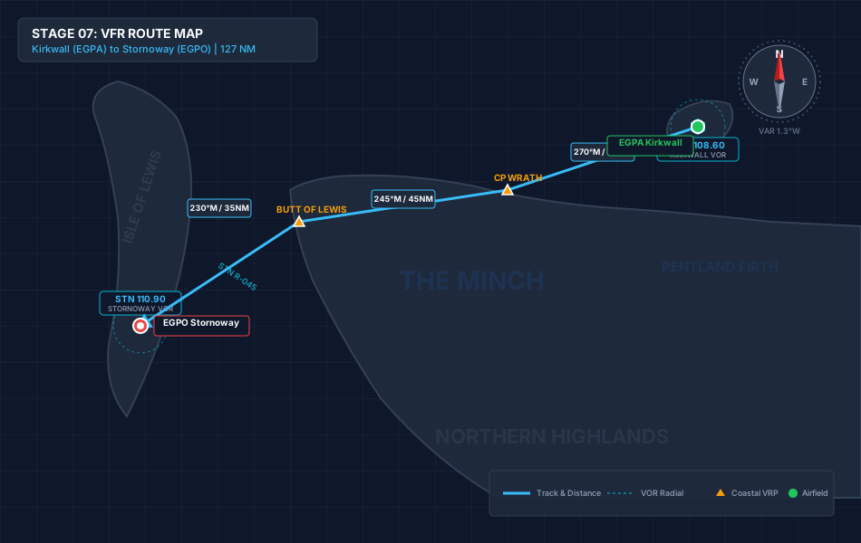
KWL VOR/DME (108.60): Outbound tracking reference from Orkney
STN VOR/DME (110.90): Inbound terminal guidance into Stornoway
STORNOWAY TOWER (118.605): Terminal control & circuit coordination
Navigation & Waypoint Breakdown
| Ident | Type | Track (°M) | Nav Aid / Radial | Alt | Leg | Total | ETE | Landmarks & Notes |
|---|---|---|---|---|---|---|---|---|
| EGPA | Departure | — | KWL 108.60 R-270 | 52 ft | 0.0 NM | 0.0 NM | 00:00 | Depart Kirkwall; climb west out of the Orkney airspace. |
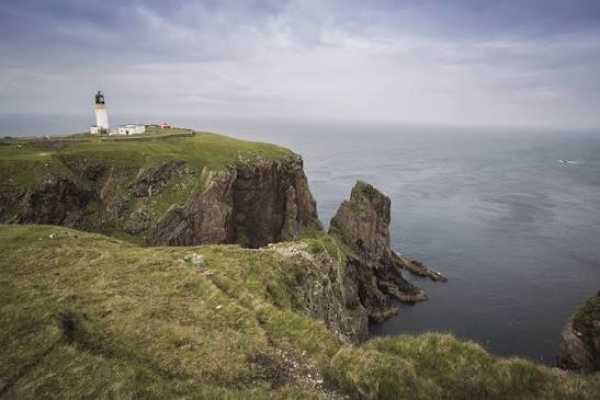
| CPWRATH | Coastal VRP | 245° | STN 110.90 R-045 | 3,500 ft | 70.0 NM | 70.0 NM | 00:42 | Pass Cape Wrath lighthouse; entry point for Atlantic crossing. |
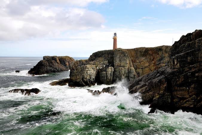
| BUTTOFLEWIS | Scenic VRP | 230° | STN 110.90 R-350 | 3,500 ft | 35.0 NM | 105.0 NM | 01:03 | Landfall at the northern tip of the Outer Hebrides; turn south. |
| EGPO | Arrival | 175° | STN 110.90 R-355 | 26 ft | 22.0 NM | 127.0 NM | 01:16 | Follow eastern Lewis coastline down for full-stop at Stornoway. |
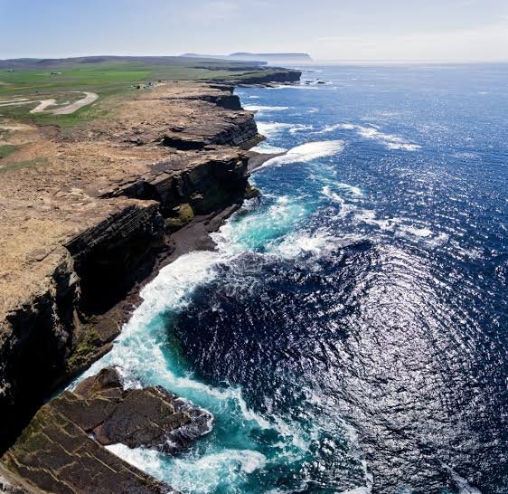
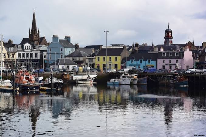
Stage Highlights & Scenic Landmarks
Radio Navigation Frequencies
- Stornoway VOR/DME (STN): 110.90 MHz
- Kirkwall VOR/DME (KWL): 108.60 MHz
- Stornoway Tower: 118.605 MHz
- Scottish Information: 119.875 MHz
Local Cautions & Procedures
- Atlantic Open Water: Substantial over-water transit across the Minch and northern Atlantic. Ensure life preservers and emergency gear are noted.
- Hebridean Weather: Fast-moving frontal systems roll in off the Atlantic. Monitor pressure trends and cloud bases around Cape Wrath.
- Stornoway Arrival: Active civil/military airport; establish contact early with Stornoway Tower for circuit entry.
Download MSFS Flight Plan (.PLN)
Copy the XML snippet below and save it as UK_Coastal_Stage_07.pln to load directly into Microsoft Flight Simulator:
<?xml version="1.0" encoding="UTF-8"?>
<SimBase.Document>
    <FlightPlan.FlightPlan>
        <Title>EGPA to EGPO Stage 7 UK Coastal Circumnavigation</Title>
        <FPType>VFR</FPType>
        <RouteType>Direct</RouteType>
        <CruisingAlt>3500</CruisingAlt>
        <DepartureID>EGPA</DepartureID>
        <DepartureLLA>N58° 57' 17.00",W2° 54' 12.00",+000052.00</DepartureLLA>
        <DestinationID>EGPO</DestinationID>
        <DestinationLLA>N58° 12' 54.00",W6° 19' 54.00",+000026.00</DestinationLLA>
        <ATCWaypoint id="EGPA">
            <ATCWaypointType>Airport</ATCWaypointType>
            <WorldPosition>N58° 57' 17.00",W2° 54' 12.00",+000052.00</WorldPosition>
            <ICAO><ICAORegion>EG</ICAORegion><ICAOIdent>EGPA</ICAOIdent></ICAO>
        </ATCWaypoint>
        <ATCWaypoint id="CPWRATH">
            <ATCWaypointType>User</ATCWaypointType>
            <WorldPosition>N58° 37' 30.00",W4° 59' 45.00",+003500.00</WorldPosition>
        </ATCWaypoint>
        <ATCWaypoint id="BUTTOFLEWIS">
            <ATCWaypointType>User</ATCWaypointType>
            <WorldPosition>N58° 30' 30.00",W6° 15' 12.00",+003500.00</WorldPosition>
        </ATCWaypoint>
        <ATCWaypoint id="EGPO">
            <ATCWaypointType>Airport</ATCWaypointType>
            <WorldPosition>N58° 12' 54.00",W6° 19' 54.00",+000026.00</DestinationLLA>
            <ICAO><ICAORegion>EG</ICAORegion><ICAOIdent>EGPO</ICAOIdent></ICAO>
        </ATCWaypoint>
    </FlightPlan.FlightPlan>
</SimBase.Document>